From vent to archive
Proximal deposits record eruption processes; distant tephra layers preserve the regional footprint of the same events.
 MSCA · Sapienza University of Rome
Reconstructing the recent eruptive history of Central Anatolia to strengthen tephrochronology and volcanic-hazard assessment.
PÜSKÜRÜM combines field geology, volcanic-glass geochemistry and geochronology to identify the principal Late Quaternary eruptions of Acıgöl, Hasan Dağı and Erciyes, then trace their ash from proximal deposits to distant sedimentary and archaeological archives.
Explosive volcanic eruptions emit violently fragmented pyroclastic material into the atmosphere, depositing ash layers (tephra) over extensive areas, which can affect large populations and the environment. At the same time, these tephra layers constitute chronostratigraphic horizon markers (or isochrones) in a wide variety of sedimentary records (including paleoclimatic and archaeological sequences), so their correlation becomes crucial for synchronizing records and for establishing how past explosive eruptions have affected a region and its occupants. Since the fine ash can be dispersed over thousands of kilometres, a key way to correlate tephra is by comparing the chemical composition of the volcanic glass.

Formation of the convecting column and mushroom-type cloud during an explosive eruption of the Calbuco Volcano.
View from Puerto Montt city, Chile, April 2015; Source link.
Proximal deposits record eruption processes; distant tephra layers preserve the regional footprint of the same events.
Once matched by glass chemistry, tephra horizons synchronize climate, archaeological and volcanic records across wide areas.

Model of ash distribution across Central America during the first five days of the Tierra Blanca Joven eruption from Ilopango caldera, El Salvador, in 431 CE. The tephra from this eruption is an example of a horizon marker that can be traced between archives.
The numbered map connects Central Anatolian volcanoes with archaeological sites and sedimentary records in which CAVP tephra may be preserved.
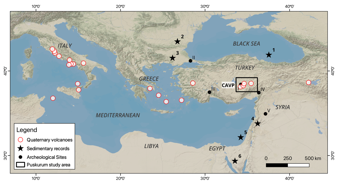
Central Anatolian tephra can connect volcanic eruptions with environmental and archaeological records across the eastern Mediterranean. The numbered archives include the Black Sea (1), Lakes Brazi and Lia in Romania (2), the Philippi basin in Greece (3), the Yammouneh basin in Lebanon (4) and Sodmein Cave in Egypt (6).
Archaeological sites. (I) Kaletepe Deresi 3 · (II) Yamburgaz Cave · (III) Karain Cave · (IV) Dursunlu · (V) Latamne.
Archive references. (1) Cullen et al. (2014) · (2) Kearney et al. (2024) · (3) Wulf et al. (2018) · (4) Develle et al. (2009) · (6) Barton et al. (2015).
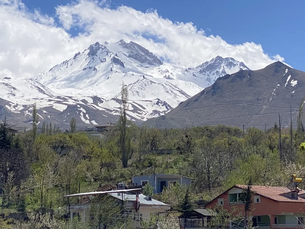
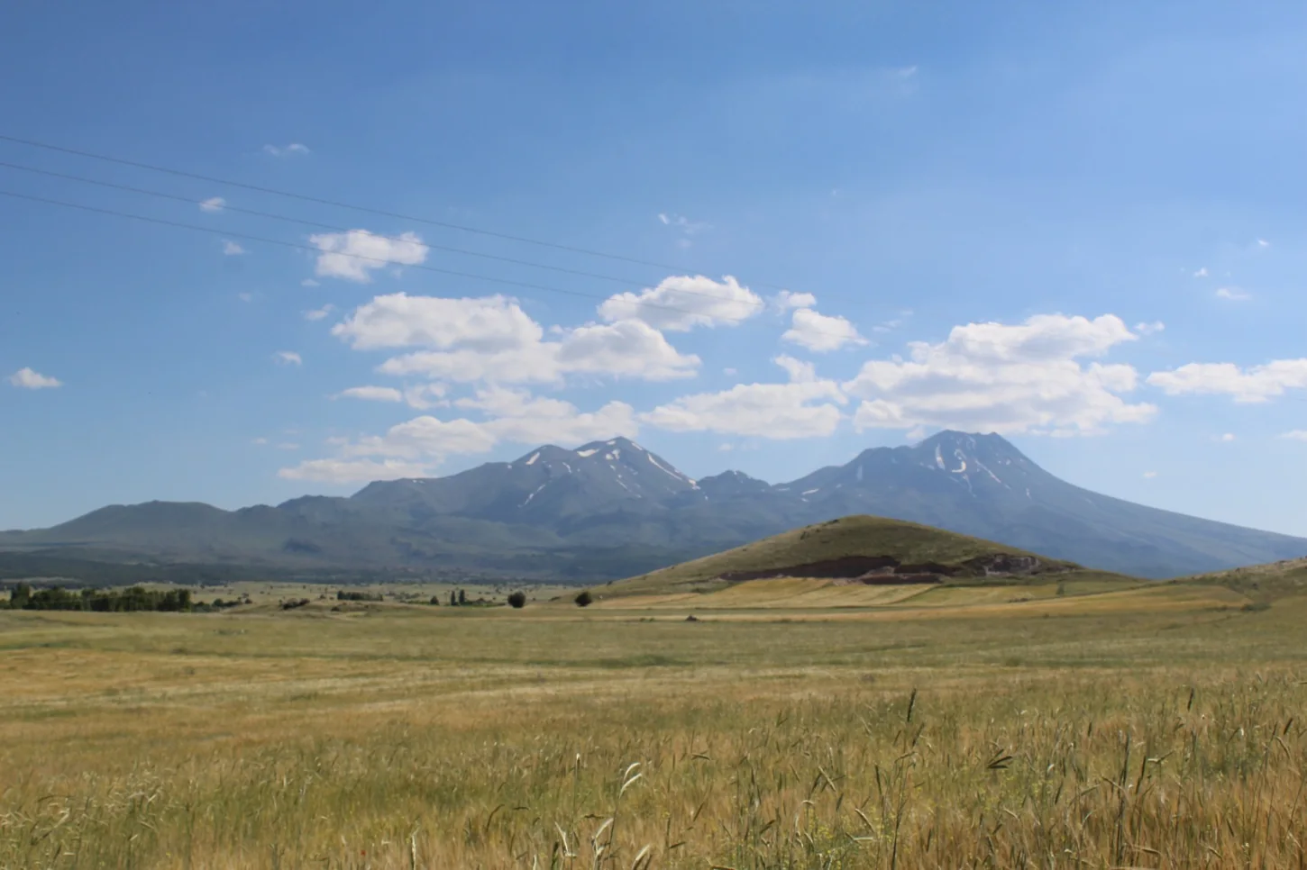
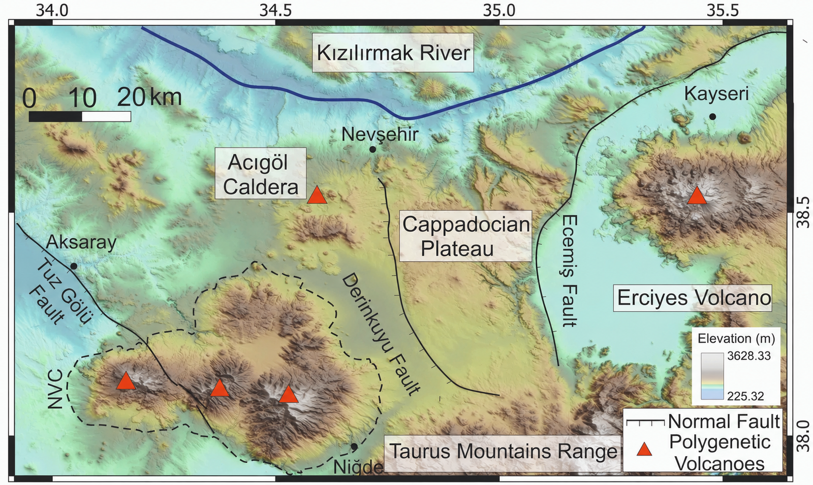 Hasan Dağı
The PÜSKÜRÜM project aims to distinguish and characterise proximal pyroclastic deposits within the Central Anatolian Volcanic Province (CAVP) through geological mapping, sampling, description and stratigraphic logging in the field, and through volcanic-glass analyses (EMP and LA-ICP-MS) and geochronological dating (14C, 234U/230Th and 40Ar/39Ar) in the laboratory.
This work identifies major explosive eruptions in Central Anatolia from the Middle Pleistocene to the Holocene. The main objective is to reconstruct the eruptive history of Acıgöl caldera and the Hasan Dağı and Erciyes stratovolcanoes. A catalogue of past eruptions, including their magnitude, style and frequency, is essential to improve volcanic hazard assessment and help communities prepare for future eruptions.
The project’s chemical database helps fill gaps in the tephrostratigraphic framework of eastern Europe. By correlating distal tephra layers, PÜSKÜRÜM helps synchronise palaeoenvironmental, palaeoclimatic and archaeological records.
Document stratigraphic relationships, sample key units and reconstruct eruption sequences around the principal volcanic centres.
Combine EMP and LA-ICP-MS analyses to distinguish volcanic sources and test regional correlations.
Integrate radiocarbon, U–Th and Ar–Ar constraints into a consistent chronological framework.
Two studies reconstruct a Plinian eruption and the history of a caldera within the volcanic complex.
Eruption dynamics, phreatomagmatic precursors and caldera collapse recorded by the Upper Acıgöl Tuff.
Read the Bulletin of Volcanology article →Holocene explosive activity reconstructed from proximal deposits and distal archives.
Major- and trace-element data for correlating volcanic glass across regional and distal tephra records.
Open the PÜSKÜRÜM data repository →Rebecca J. Kearney, Ivan Sunyé-Puchol and Rengin Özsoy-Ünal trace tephra across Anatolia, the Levant and Arabia.
Read the article →The contribution presented correlations between deposits at Erciyes and tephra records from the Black Sea, Romanian lakes and the Mediterranean.
Read the abstract →The study reconstructs the sequence of eruptions and collapse recorded in the youngest Cappadocian caldera-forming ignimbrite.
Read the study →The study combines deposits near the volcano with tephra layers preserved in distant archives.
Read the study →Horizon 2020 was the European Union’s research and innovation funding programme for 2014–2020. PÜSKÜRÜM was supported through its Marie Skłodowska-Curie Actions under Grant Agreement No. 101024337.


Principal Investigator (PI):
Dr Ivan Sunyé-Puchol